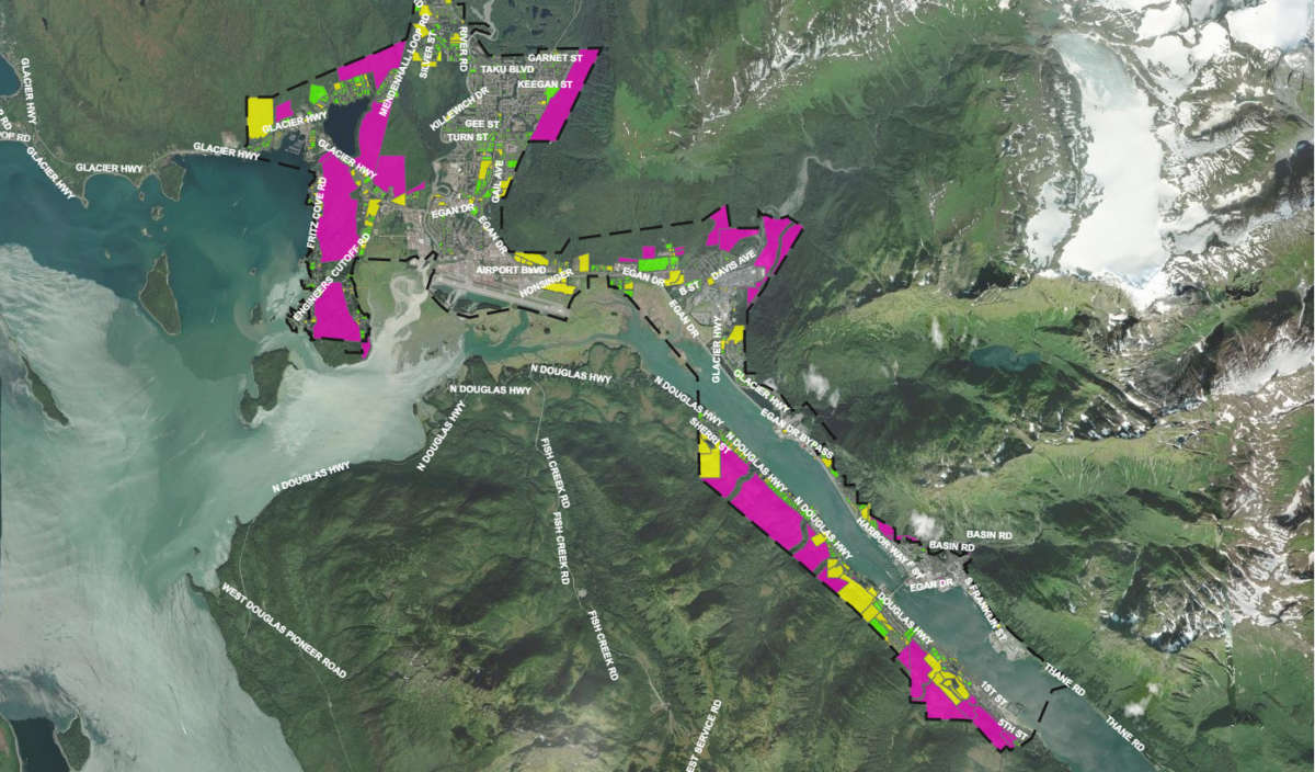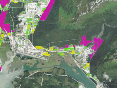
Inventory of Vacant & Underdeveloped Properties
Project Contact Information
If you have questions, please contact Joseph Meyers, Housing & Land Use Specialist at [email protected]
Overview
This inventory map was created to provide detailed information on publicly and privately owned lands within the City and Borough of Juneau.
Map elements include:
- Current and historic zoning
- Urban Service area boundary
- Vacant lands, private and CBJ-owned
- Developed private properties below the maximum allowable residential density
- Adopted severe hazard maps (adopted)
- Severe landslide and avalanche maps (Tetra Tech)
- Wetlands maps
- Flood zone maps
- Anadromous streams and stream protection corridors
- Slopes in excess of 18%
Project Goal
To provide insight into the potential of public and privately held land within the CBJ to support additional housing density and identify challenges to development of these lands.
Click below to view the Vacant and Underdeveloped Properties Inventory Map